No NWS advisory in effect for these zones.
- NWS alerts and marine forecast 23:05 EDT
- Oregon Inlet to Cape Hatteras, out 20nmNE 15 ktNE 3ft@11s, S 3ft@5sRailRough
- Oregon Inlet to Cape Hatteras, 20-60nmN 10 ktmodel 2.3 ft · N 2ft@5sRail · modelLively
- Currituck Beach Lt to Oregon Inlet, out 20nmNE 15 ktN 4ft@7s, S 1ft@5sRailLively
- Currituck Beach Lt to Oregon Inlet, 20-60nmNE 15 ktmodel 2.9 ft · NNE 2ft@5sRail · modelLively
- Oregon Inlet to Cape Hatteras, out 20nmSE 10 ktNE 3ft@10s, S 2ft@5sRailLively
- Oregon Inlet to Cape Hatteras, 20-60nmS 15 ktmodel 3.1 ft · NNE 2ft@6sRail · modelLively
- Currituck Beach Lt to Oregon Inlet, out 20nmE 10 ktNE 3ft@7s, S 2ft@5sRailLively
- Currituck Beach Lt to Oregon Inlet, 20-60nmE 5 ktmodel 3.4 ft · NNE 3ft@6sRail · modelLively
- Oregon Inlet to Cape Hatteras, out 20nmSW 10 ktNE 3ft@8s, S 2ft@5sRailLively
- Oregon Inlet to Cape Hatteras, 20-60nmSW 15 ktmodel 3.9 ft · NE 3ft@7s, SSW 2ft@3sRail · modelRough
- Currituck Beach Lt to Oregon Inlet, out 20nmSW 10 ktNE 3ft@8s, S 2ft@6sRailLively
- Currituck Beach Lt to Oregon Inlet, 20-60nmSW 10 ktmodel 3.7 ft · NE 3ft@7sRail · modelLively
- Oregon Inlet to Cape Hatteras, out 20nmN 15 ktN 4ft@9s, SW 2ft@5sRailLively
- Oregon Inlet to Cape Hatteras, 20-60nmNW 20 ktmodel 3.7 ft · NE 2ft@8s, NNW 1ft@3sRail · modelLively
- Currituck Beach Lt to Oregon Inlet, out 20nmN 15 ktNE 4ft@8s, S 2ft@5sRailLively
- Currituck Beach Lt to Oregon Inlet, 20-60nmN 15 ktmodel 3.7 ft · NE 2ft@8s, N 2ft@3sRail · modelRough
- Oregon Inlet to Cape Hatteras, out 20nmN 20 kt G25NE 5ft@8s, S 1ft@7sRailLively
- Oregon Inlet to Cape Hatteras, 20-60nmN 20 kt G25model 5.4 ft · ENE 1ft@9s, NNE 5ft@6sRail · modelRough
- Currituck Beach Lt to Oregon Inlet, out 20nmN 20 kt G25NE 5ft@8s, S 1ft@7sRailLively
- Currituck Beach Lt to Oregon Inlet, 20-60nmN 20 kt G25model 5.1 ft · E 1ft@8s, NNE 5ft@5sRail · modelRough
- Oregon Inlet to Cape Hatteras, out 20nmNE 20 kt G25N 6ft@7sRailRough
- Oregon Inlet to Cape Hatteras, 20-60nmNE 20 kt G25model 5.6 ft · SE 1ft@7s, NE 6ft@6sRail · modelRough
- Currituck Beach Lt to Oregon Inlet, out 20nmNE 20 kt G25N 1ft@8s, NE 5ft@7sRailLively
- Currituck Beach Lt to Oregon Inlet, 20-60nmNE 20 kt G25model 5.1 ft · SE 1ft@7s, NE 5ft@6sRail · modelRough
- Oregon Inlet to Cape Hatteras, out 20nmNE 15 ktno Wave Detail this period — no rail time
- Oregon Inlet to Cape Hatteras, 20-60nmNE 15 ktmodel 4.9 ft · SE 0ft@6s, NE 5ft@7sRail · modelLively
- Currituck Beach Lt to Oregon Inlet, out 20nmNE 15 ktmodel 3.5 ft · ENE 0ft@14s, NE 3ft@7sRail · modelLively
- Currituck Beach Lt to Oregon Inlet, 20-60nmNE 15 ktmodel 4.4 ft · SE 0ft@6s, NE 4ft@7sRail · modelLively
- Oregon Inlet to Cape Hatteras, out 20nmNE 15 ktno Wave Detail this period — no rail time
- Oregon Inlet to Cape Hatteras, 20-60nmNE 15 ktmodel 3.7 ft · ENE 1ft@7s, ENE 3ft@6sRail · modelLively
- Currituck Beach Lt to Oregon Inlet, out 20nmNE 15 ktmodel 2.6 ft · ENE 3ft@5sRail · modelLively
- Currituck Beach Lt to Oregon Inlet, 20-60nmNE 15 ktmodel 3.1 ft · ENE 1ft@7s, ENE 3ft@6sRail · modelLively
- Oregon Inlet to Cape Hatteras, out 20nmNE 10 ktno Wave Detail this period — no rail time
- Oregon Inlet to Cape Hatteras, 20-60nmNE 15 ktmodel 3.6 ft · ENE 1ft@7s, E 3ft@6sRail · modelLively
- Currituck Beach Lt to Oregon Inlet, out 20nmNE 10 ktmodel 2.3 ft · ENE 1ft@7s, E 2ft@5sRail · modelLively
- Currituck Beach Lt to Oregon Inlet, 20-60nmNE 10 ktmodel 3.0 ft · NNE 1ft@5s, ESE 3ft@5sRail · modelLively
- Oregon Inlet to Cape Hatteras, out 20nmNE 10 ktno Wave Detail this period — no rail time
- Oregon Inlet to Cape Hatteras, 20-60nmNE 15 ktmodel 4.0 ft · ESE 4ft@7sRail · modelLively
- Currituck Beach Lt to Oregon Inlet, out 20nmNE 10 ktmodel 2.6 ft · ENE 0ft@7s, E 3ft@6sRail · modelLively
- Currituck Beach Lt to Oregon Inlet, 20-60nmNE 10 ktmodel 3.4 ft · ESE 3ft@6sRail · modelLively
Through the day
—Drag across the chart, or use the arrow keys, to read the tide at any hour. Wind and seas are not animated — NWS publishes two periods a day, and this will not invent hours it does not have.Where the breaks are
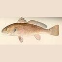
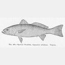
Fishing guide
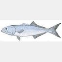
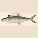
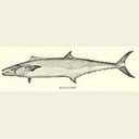 1King Mackerelpeak
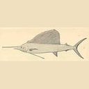 2Sailfishpeak
- 3White Marlinpeak
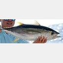 4Yellowfin Tunapeak
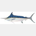 5Blue Marlin
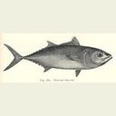 6Bluefin Tuna
Species and their seasons are the operator’s own local knowledge, not survey data; depth, prey and gear rules from the NOAA species directory; season from the operator’s own recorded local knowledge — not a survey, so it carries no sample size and no error bars. The gear line says a rule exists, not what it is — check current limits before you keep anything. Nothing here is a recommendation to go.
Spread layout and trolling speed are not here: no agency publishes them. That is the part still marked Soon.
Charts
Oregon Inlet
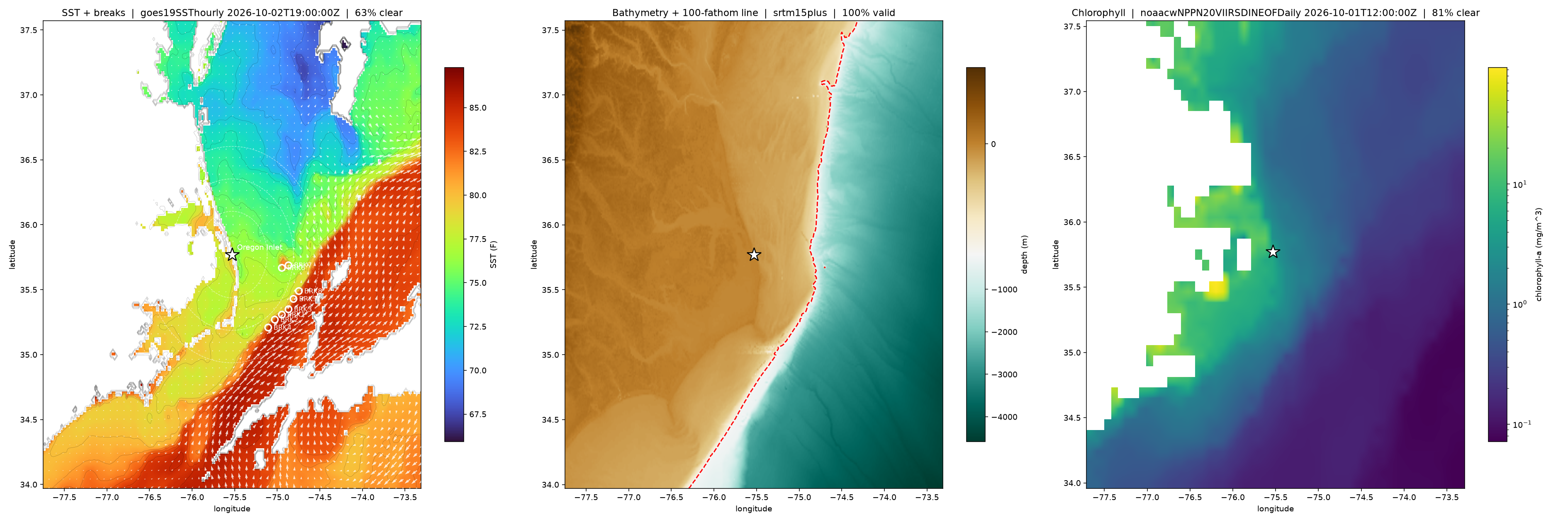
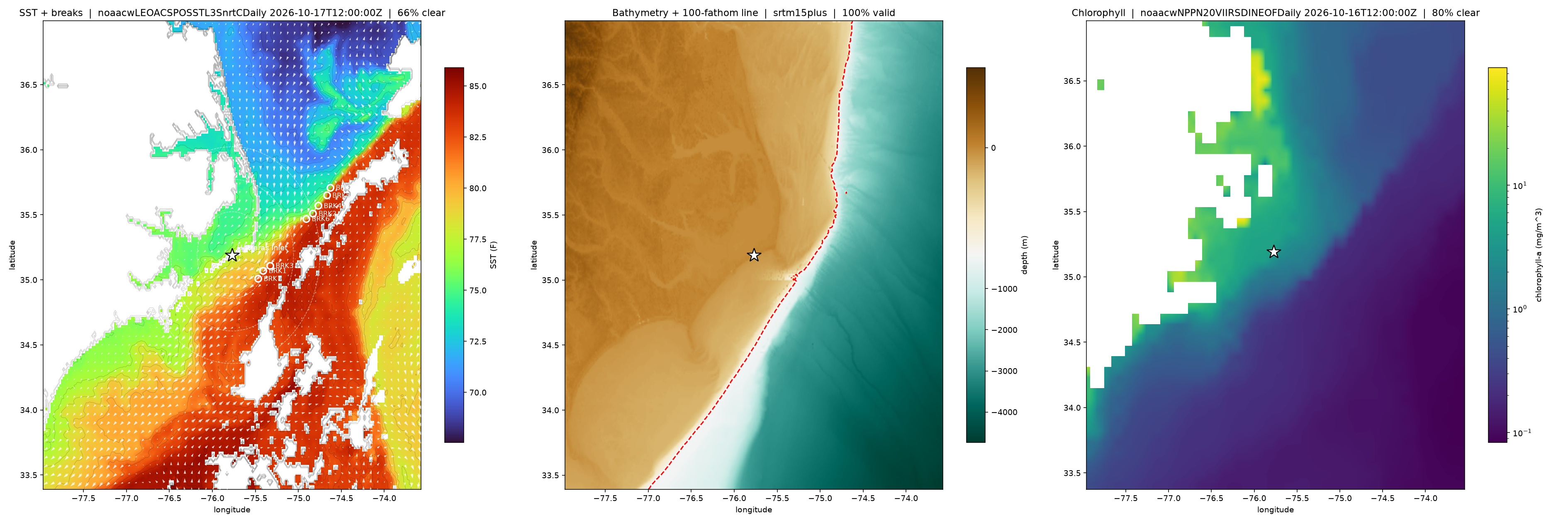
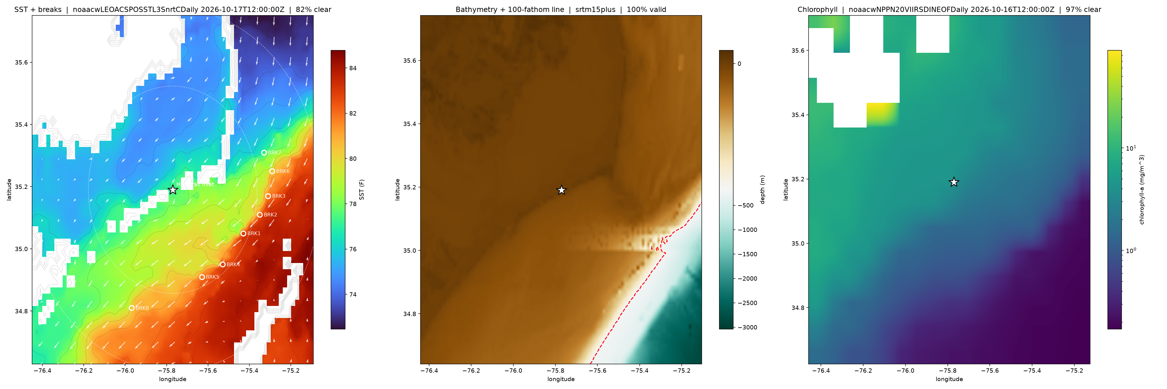
SST with breaks, bathymetry, chlorophyll. Rendered light-only — tap for full size.
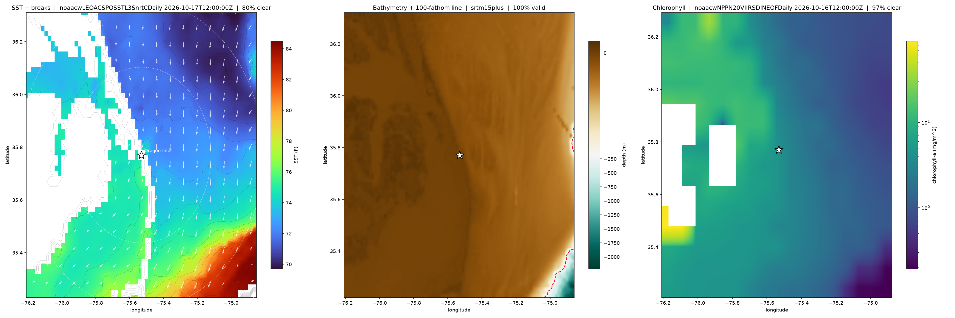
Show raw brief text
OFFSHORE BRIEF  2026-10-04
Oregon Inlet
search radius 100 nm
NWS: no active advisory for these zones
limits: yours, set 2026-08-20 (4 ft seas / 18 kt wind)
==============================================================
THE CAPTAIN DECIDES. Nothing here is a recommendation. This reports what
NWS has issued, estimates how rough the ride will feel, and flags when
the forecast exceeds the limits you set -- it does not know your boat,
your crew, your fuel, or what the inlet looks like this morning, and it
never tells you the conditions are fine. Whether to go -- and when to
turn back -- is the captain's call and the captain's responsibility.
==============================================================

MARINE FORECAST
  AMZ152  Oregon Inlet to Cape Hatteras, out 20nm
    TONIGHT      NE 15 kt   swell: NE 3ft@11s, S 3ft@5s   rail: Rough
                 NE winds 10 to 15 kt, diminishing to 5 to 10 kt after midnight. Seas around 3 ft. Wave Detail: S 3 ft at 5 seconds and NE 3 ft at 11 seconds. A slight
    SUN          SE 10 kt   swell: NE 3ft@10s, S 2ft@5s   rail: Lively
                 SE winds 5 to 10 kt, becoming SW in the afternoon. Seas around 3 ft. Wave Detail: NE 3 ft at 10 seconds and S 2 ft at 5 seconds. Showers with a slight
    SUN NIGHT    SW 10 kt   swell: NE 3ft@8s, S 2ft@5s   rail: Lively
                 SW winds around 10 kt, becoming W after midnight. Seas 3 to 4 ft. Wave Detail: NE 3 ft at 8 seconds and S 2 ft at 5 seconds. Showers with a chance of
    MON          N 15 kt   swell: N 4ft@9s, SW 2ft@5s   rail: Lively
                 N winds 10 to 15 kt. Seas 3 to 4 ft. Wave Detail: N 4 ft at 9 seconds and SW 2 ft at 5 seconds. Rain.
    MON NIGHT    N 20 kt G25   swell: NE 5ft@8s, S 1ft@7s   rail: Lively
                 N winds 15 to 20 kt with gusts up to 25 kt. Seas 4 to 6 ft. Wave Detail: NE 5 ft at 8 seconds and S 1 ft at 7 seconds. A slight chance of rain in the
    TUE          NE 20 kt G25   swell: N 6ft@7s   rail: Rough
                 NE winds 15 to 20 kt with gusts up to 25 kt. Seas 4 to 6 ft. Wave Detail: N 6 ft at 7 seconds.
    TUE NIGHT    NE 15 kt
                 NE winds 10 to 15 kt. Seas 4 to 5 ft.
    WED          NE 15 kt
                 NE winds 10 to 15 kt. Seas 3 to 5 ft.
    WED NIGHT    NE 10 kt
                 NE winds 5 to 10 kt. Seas 3 to 4 ft.
    THU          NE 10 kt
                 NE winds 5 to 10 kt. Seas 3 to 4 ft.
  AMZ182  Oregon Inlet to Cape Hatteras, 20-60nm
    TONIGHT      N 10 kt
                 N winds 5 to 10 kt, becoming NE late. Seas 2 to 3 ft. A chance of showers. A slight chance of tstms this evening, then a chance of tstms after midnigh
    SUN          S 15 kt
                 S winds 5 to 10 kt, becoming SW 10 to 15 kt in the afternoon. Seas 3 to 4 ft. Showers with a chance of tstms in the morning, then showers likely with
    SUN NIGHT    SW 15 kt
                 SW winds 10 to 15 kt. Seas 3 to 4 ft. A chance of tstms. Showers in the evening, then rain after midnight. Vsby 1 to 3 NM.
    MON          NW 20 kt
                 NW winds 10 to 15 kt, becoming N 15 to 20 kt in the afternoon. Seas 3 to 4 ft. Rain.
    MON NIGHT    N 20 kt G25
                 N winds 15 to 20 kt with gusts up to 25 kt. Seas 4 to 5 ft, building to 5 to 7 ft after midnight. A chance of rain in the evening.
    TUE          NE 20 kt G25
                 NE winds 15 to 20 kt with gusts up to 25 kt. Seas 6 to 7 ft.
    TUE NIGHT    NE 15 kt
                 NE winds 10 to 15 kt. Seas 5 to 7 ft.
    WED          NE 15 kt
                 NE winds 10 to 15 kt. Seas 4 to 5 ft.
    WED NIGHT    NE 15 kt
                 NE winds 10 to 15 kt, diminishing to 5 to 10 kt after midnight. Seas 3 to 5 ft.
    THU          NE 15 kt
                 NE winds 10 to 15 kt. Seas 3 to 5 ft.
  AMZ150  Currituck Beach Lt to Oregon Inlet, out 20nm
    TONIGHT      NE 15 kt   swell: N 4ft@7s, S 1ft@5s   rail: Lively
                 NE winds 10 to 15 kt, diminishing to 5 to 10 kt after midnight. Seas 3 to 4 ft. Wave Detail: N 4 ft at 7 seconds and S 1 ft at 5 seconds. A chance of
    SUN          E 10 kt   swell: NE 3ft@7s, S 2ft@5s   rail: Lively
                 E winds 5 to 10 kt, becoming S in the afternoon. Seas around 3 ft. Wave Detail: NE 3 ft at 7 seconds and S 2 ft at 5 seconds. Showers with a slight ch
    SUN NIGHT    SW 10 kt   swell: NE 3ft@8s, S 2ft@6s   rail: Lively
                 SW winds around 10 kt, becoming NW after midnight. Seas 3 to 4 ft. Wave Detail: NE 3 ft at 8 seconds and S 2 ft at 6 seconds. A slight chance of tstms
    MON          N 15 kt   swell: NE 4ft@8s, S 2ft@5s   rail: Lively
                 N winds 10 to 15 kt. Seas 3 to 4 ft. Wave Detail: NE 4 ft at 8 seconds and S 2 ft at 5 seconds. A chance of rain.
    MON NIGHT    N 20 kt G25   swell: NE 5ft@8s, S 1ft@7s   rail: Lively
                 N winds 15 to 20 kt with gusts up to 25 kt. Seas 3 to 5 ft. Wave Detail: NE 5 ft at 8 seconds and S 1 ft at 7 seconds.
    TUE          NE 20 kt G25   swell: N 1ft@8s, NE 5ft@7s   rail: Lively
                 NE winds 15 to 20 kt. Gusts up to 25 kt in the morning. Seas 4 to 5 ft. Wave Detail: NE 5 ft at 7 seconds and N 1 ft at 8 seconds.
    TUE NIGHT    NE 15 kt
                 NE winds 10 to 15 kt. Seas 3 to 5 ft.
    WED          NE 15 kt
                 NE winds 10 to 15 kt. Seas 3 to 4 ft.
    WED NIGHT    NE 10 kt
                 NE winds 5 to 10 kt. Seas 2 to 3 ft.
    THU          NE 10 kt
                 NE winds 5 to 10 kt. Seas around 3 ft.
  AMZ180  Currituck Beach Lt to Oregon Inlet, 20-60nm
    TONIGHT      NE 15 kt
                 NE winds 10 to 15 kt, diminishing to 5 to 10 kt late this evening and overnight. Seas around 3 ft. A slight chance of rain until early morning. A slig
    SUN          E 5 kt
                 E winds around 5 kt, becoming S in the afternoon. Seas 3 to 4 ft. A slight chance of tstms. Showers. Vsby 1 to 3 NM.
    SUN NIGHT    SW 10 kt
                 SW winds around 10 kt, becoming W after midnight. Seas 3 to 4 ft. A slight chance of tstms. Showers in the evening, then rain after midnight. Vsby 1 t
    MON          N 15 kt
                 N winds 10 to 15 kt. Seas 3 to 4 ft. Rain likely.
    MON NIGHT    N 20 kt G25
                 N winds 15 to 20 kt with gusts up to 25 kt. Seas 4 to 6 ft.
    TUE          NE 20 kt G25
                 NE winds 15 to 20 kt. Gusts up to 25 kt in the morning. Seas 5 to 6 ft.
    TUE NIGHT    NE 15 kt
                 NE winds 10 to 15 kt. Seas 4 to 6 ft.
    WED          NE 15 kt
                 NE winds 10 to 15 kt. Seas 3 to 4 ft.
    WED NIGHT    NE 10 kt
                 NE winds 5 to 10 kt. Seas 3 to 4 ft.
    THU          NE 10 kt
                 NE winds 5 to 10 kt. Seas 3 to 4 ft.

BUOYS
  44095 Oregon Inlet     wind – kt @ –  seas 3.3 ft @ 6.0 s  water 74.8 F   2026-10-03 22:26 EDT
  41025 Diamond Shoals   wind 3.9 kt @ 060T  seas – ft @ – s  water 81.0 F   2026-10-03 22:40 EDT

SATELLITE

SST ANOMALY  (NOAA Coral Reef Watch, published)
  +0.9 F  (+0.48 C)  2026-10-01, 49 cells

TIDE  (CO-OPS 8652587, station-local, predictions)
  Sun 02:50  1.2 ft  high
  Sun 09:17  0.5 ft  low
  Sun 15:17  1.4 ft  high
  Sun 22:24  0.5 ft  low
  goes19SSThourly 2026-10-02T19:00:00Z   63% cloud-free

BATHYMETRY
  srtm15plus   100% valid

  WPT          LAT        LON    SST   GRAD    RNG   BRG   DEPTH   SHELF       CHL     POINT
  ------------------------------------------------------------------------------------------
  BRK1     35.3100   -74.9500   82.1   1.76   39.6   134   -365m   0.1nm  0.035/nm    16.5nm
  BRK2     35.2700   -75.0300   82.2   1.75   38.7   141   -105m   1.1nm   0.04/nm    17.2nm
  BRK3     35.3500   -74.8700   83.4   1.71   40.9   128   -576m   1.6nm  0.036/nm    17.1nm
  BRK4     35.2100   -75.1100   82.5   1.83   39.4   148    -86m   2.3nm  0.047/nm    20.2nm
  BRK5     35.4300   -74.8100   80.5   1.54   40.6   120   -597m   1.4nm  0.035/nm    16.8nm
  BRK6     35.6700   -74.9500   78.7   1.48   28.9   102    -52m   5.9nm  0.018/nm    11.2nm
  BRK7     35.6900   -74.8700   79.0   1.30   32.5    98    -79m   1.9nm  0.022/nm    15.0nm
  BRK8     35.4900   -74.7500   79.5   1.47   41.6   114  -1279m   2.7nm  0.035/nm    18.5nm

FRONT MOVEMENT
  top break has walked 10.3nm @ 035T over 1.3 days (prior pass 2026-10-01T12:00:00Z)

OFFSHORE WAVES  (WAVEWATCH III, model -- not NWS text)
  TONIGHT      2.3 ft   rail: Lively   (2026-10-04T03:00:00Z)
  SUN          3.1 ft   rail: Lively   (2026-10-04T15:00:00Z)
  SUN NIGHT    3.9 ft   rail: Rough   (2026-10-05T03:00:00Z)
  MON          3.7 ft   rail: Lively   (2026-10-05T15:00:00Z)
  MON NIGHT    5.4 ft   rail: Rough   (2026-10-06T03:00:00Z)
  TUE          5.6 ft   rail: Rough   (2026-10-06T15:00:00Z)

CHLOROPHYLL
  noaacwNPPN20VIIRSDINEOFDaily 2026-10-01T12:00:00Z   81% cloud-free

CURRENTS
  rtofs_us_east_scraped (RUCOOL/NCEP)  MT[10478]  69% valid
  1.13 kt @ 045T near top waypoint (1.3nm to nearest modeled cell)

AIS TRAFFIC
  shipping-lane overlay -> out/ais_oregon.png

  chart -> out/sst_oregon_2026-10-04.png
  waypoints -> out/breaks_oregon_2026-10-04.gpx
  map -> out/map.html?port=oregon

CONDITIONS SCORE  (margin left against YOUR limits -- not a safety verdict)
  20.8/100  from: wind 17, seas 25

FISHING SCORE  (not shown on the page -- this number has never been
                checked against a real trip)
  66.0/100  confidence 0.33
  from: tide 50, structure 92
  missing: access, personal_history, recent_reports, season, water_temperature, wind

CALIBRATION
  logged 40 periods + 2 buoy obs -> out/calibration_log.jsonl

AI FISHING GUIDE -- COMING SOON
coming soon -- this guide is being redesignedThe captain decidesNothing here is a recommendation.What this page does →
This page reports what NWS has issued and estimates how rough the ride will feel. An NWS advisory is the only thing it warns you about. It does not know your boat, your crew, your fuel, or what the inlet looks like this morning — and it never tells you conditions are fine. Whether to go — and when to turn back — is the captain's call and the captain's responsibility. What these readings mean →